Global Geospatial Solutions Market By Solution Type (Software, Hardware and Services) By Application (Surveying & Mapping, Geovisualization, Planning & Analysis, Asset Management and Others) By Technology (Earth Observation, Gnss & Positioning, Geospatial Analytics and Scanning) By End User (Utility, Defense & Intelligence, Infrastructural Development, Transportation, Business, Natural Resource and Others)
Report Id: KBV-2816Publication Date: September-2019Number of Pages: 336Report Format: PDF + Excel
Special Offering:
Industry Insights | Market Trends Highest number of Tables | 24/7 Analyst Support
The Global Geospatial Solutions Market size is expected to reach $549.1 billion by 2025, rising at a market growth of 15.6% CAGR during the forecast period. A broad variety of factors drive the geospatial solutions industry, including advances in geospatial technologies with the advent of artificial intelligence and big data analytics. The inclusion of geospatial systems with conventional processes is another consideration that speeds up market growth. On the contrary, regulations and legal problems were discovered to impede the development pace of the industry.
Geospatial technology includes GPS (global positioning systems), GIS (geographical information systems), and RS (remote sensing), a technology that offers a radically different way of producing and using maps that are needed to manage communities and industries. Developed economies are anticipated to offer more speed to the industry for geospatial solutions. Globally, the application of geospatial techniques has seen a steady increase over the last few years. This, along with the simple accessibility of geospatial technology in advanced nations such as the United States and Canada, will certainly improve the market in the region.
Remote sensing, geographic information systems and global positioning systems are the categories of spatial technologies used in industrial applications. Satellite imagery and geospatial data from satellite or aerial cameras has been referred to as remote sensing. Some business satellite image can generate 30 centimeters of detail. Satellite imagery significantly enhances a GIS mapping project and acts as an information and data source to promote geospatial analysis and modeling evaluation and classification.
Based on Solution Type, the market is segmented into Software, Hardware and Services. Based on Application, the market is segmented into Surveying & Mapping, Geovisualization, Planning & Analysis, Asset Management and Others. Based on Technology, the market is segmented into Earth Observation, Gnss & Positioning, Geospatial Analytics and Scanning. Based on End User, the market is segmented into Utility, Defense & Intelligence, Infrastructural Development, Transportation, Business, Natural Resource and Others.
Based on Regions, the market is segmented into North America, Europe, Asia Pacific, and Latin America, Middle East & Africa. Due to the greater use of geospatial systems in the region, North America has been the biggest market for geospatial solutions in 2018. Asia Pacific is anticipated to be the fastest expanding market for geospatial solutions. The demand for geospatial solutions is anticipated to develop at the highest pace worldwide during the forecast period in nations like the US, Canada, the UK, and China.
The major strategies followed by the market participants are Product launches and Partnerships & Collaborations. Based on the Analysis presented in the Cardinal matrix, Microsoft Corporation, Oracle Corporation, Amazon.com, Inc., Apple, Inc., and IBM Corporation are some of the forerunners in the Geospatial Solutions Market. The market research report covers the analysis of key stake holders of the market. Key companies profiled in the report include Apple, Inc., Oracle Corporation, Microsoft Corporation, Maxar Technologies, Inc. (DigitalGlobe, Inc.), Amazon.com, Inc., IBM Corporation, SNC-Lavalin Group, Inc. (Atkins PLC), Pitney Bowes, Inc., Esri, Inc., TomTom N.V., China Geo-Engineering Corporation (CGC)( China Energy Conservation and Environmental Protection Group) and L3Harris Technologies, Inc.
The market players are adopting progressive strategies to leverage the opportunities of the market. Companies are focusing on innovative strategies to compete in the market space. For example, In March 2019, Microsoft came into partnership with XYO in which XYOs geospatial blockchain apps and services, once deployed, will be delivered in Microsoft Azures Marketplace for helping the developers to build and deploy their own geospatial blockchain applications. In April 2019, Pitney collaborated with Accenture for allowing Accenture Applied Intelligence to apply Pitney Bowes data assets for the development of new intelligent solutions; Pitney data assets comprises of location intelligence and geospatial capabilities. TomTom (Netherlands) collaborated with Microsoft in September 2019 in order to address the automakers precise and reliable navigation. During the same time, TomTom teamed up with HELLA Aglaia in order to provide the access of AutoStream to HELLA for generating map updates called Roadagrams.
Recent Strategies Deployed in Geospatial Solutions Market
» Product Launches:
Jun-2019: Esri launched new imagery exploitation tool, ArcGIS Excalibur in order to make streamline search, discovery and image analysis for Esri ArcGIS enterprise customers.
May-2019: AWS introduced AWS Ground Station, a new service to move the data to other regions using machine learning; this will be used for weather forecasting, communications and surface imaging.
Nov-2018: AWS launched SkyWatch for providing digital infrastructure for Earth Observation data distribution.
Jul-2018: DigitalGlobe, a Maxar company launched EarthWatch, a cloud-based subscription in order to view, stream and download the geospatial data of the company which helps the customers in meeting their challenges.
Jul-2018: Esri released ArcGIS Indoors in order to combine the information navigation, scheduling, and analytic capabilities for helping the businesses in understanding the coordinate space with the help of real-time processing, and location intelligence tools.
May-2018: Esri introduced Sentinel-2 Image Services and Earth observation satellite in order to deliver multi-spectral imagery for any location.
Nov-2017: Microsoft introduced Azure Location Based Services in order to fulfill the geospatial needs of industries.
May-2017: Pitney launched SendSuite Tracking Online (SSTO) which has greater location functionality.
» Acquisition and Mergers:
Oct-2016: DigitalGlobe acquired The Radiant Group for the expansion of its geospatial business solutions.
Sep-2015: Apple acquired Mapsense in order to strengthen its geo-data visualization business.
May-2015: Apple took over Coherent Navigation for improving its mapping capabilities.
» Partnerships, Collaborations and Agreements:
Sep-2019: TomTom collaborated with Microsoft in order to address the automakers precise and reliable navigation.
Sep-2019: TomTom teamed up with HELLA Aglaia in order to provide the access of AutoStream to HELLA for generating map updates called Roadagrams.
Aug-2019: Esri collaborated with Group on Earth Observations (GEO) for making Earth Observation data accessible to anyone.
Aug-2019: Esri came into partnership with Jane Goodall Institute for developing mapping tools.
Apr-2019: Pitney collaborated with Accenture for allowing Accenture Applied Intelligence to apply Pitney Bowes’ data assets for the development of new intelligent solutions; Pitney data assets comprises of location intelligence and geospatial capabilities.
Mar-2019: Microsoft came into partnership with XYO in which XYO’s geospatial blockchain apps and services, once deployed, will be delivered in Microsoft Azure’s Marketplace for helping the developers to build and deploy their own geospatial blockchain applications.
Feb-2019: Microsoft extended its partnership with TomTom in order to increase its mapping scenarios and secured location APIs for offering geospatial context to data.
Sep-2018: TomTom signed partnership agreement with STMicroelectronics in order to offer geolocation tools and services for tracking and mapping data services, location, and accelerating product development.
Sep-2018: Esri signed partnership agreement with ONDA in order to help ONDA in unlocking potential of geospatial imagery.
Jul-2018: IBM collaborated with Telit in order to integrate Telit's deviceWISE IoT platform with IBM IoT platform for bringing powerful Artificial Intelligence (AI)-based capabilities.
Jun-2018: TomTom collaborated with what3words in order to complement its geolocation tools and services for providing better solutions to the customers.
Apr-2018: Microsoft collaborated with Esri in order to launch GeoAI Data Science Virtual Machine (DSVM) as a part of Data Science Virtual Machine/Deep Learning Virtual Machine family in order to help in creating intelligent applications with the help of geospatial analytics.
Apr-2017: Pitney teamed up with Scalable Systems in which Scalable Systems will use demographic and geospatial data sets of the company for increasing the healthcare members’ experience with their insurance companies
Feb-2017: DigitalGlobe signed partnership agreement with Esri and Harris for providing the access of its high-resolution satellite imagery and the analytical and deep learning tools to Esri users in order to power the geospatial big data analytics.
Feb-2016: Pitney came into partnership with Cloudera in order to deploy geospatial processing and data quality solutions to end users on top of Cloudera Enterprise for enrichment of big data investments.
Dec-2016: DigitalGlobe partnered with BAE Systems’ Geospatial eXploitation Products™ (GXP®) group which enables the GXP platform users to access DigitalGlobe’s high-resolution, high-accuracy commercial satellite imagery for discovering and publishing the geospatial intelligence products.
Dec-2016: TomTom teamed up with Pitney Bowes in order to work together for location-based intelligence portfolio.
Oct-2016: IBM and Esri collaborated for providing the access of Esri's maps, data, geospatial tools, and analytical services to IBM users.
Oct-2016: Pitney signed an agreement with IBM for providing location-based insights to supplement the geospatial capabilities of the IBM Cognos Analytics and IBM Watson Analytics platforms.
Aug-2016: IBM signed an agreement with Mapbox for providing access of geospatial analysis and mapping to users.
Jul-2016: TomTom announced the collaboration with Sensewhere for conquering GPS black spots and bringing location-based services indoors.
Jun-2015: DigitalGlobe teamed up with NGA in order to launch open source software toolkit for using the power of crowdsourced mapping for Geospatial Big Data Analytics.
May-2015: DigitalGlobe signed an agreement with Saab Group in order to form a Joint Venture company named after Vricon, Inc., in order to produce 3D products and digital elevation models for government and enterprise geospatial markets.
» Expansions:
Aug-2018: Oracle opened a new innovation lab, a unique facility for helping the projects related to visualization, augmented reality, and artificial intelligence tools.
Apr-2018: Oracle extended its Oracle Cloud Services by adding new features to it; these features comprises of routing and geocoding.
Sep-2017: Pitney extended its data and software solutions for the better understanding of context to location.
May-2016: Apple expanded its reach to India by opening a new office in Hyderabad in order to enhance its analytics business.
Scope of the Geospatial Solutions Market Analysis
Market Segmentation:
By Solution Type
Software
Hardware
Services
By Application
Surveying & Mapping
Geovisualization
Planning & Analysis
Asset Management
Others
By Technology
Earth Observation
Gnss & Positioning
Geospatial Analytics
Scanning
By End User
Utility
Defense & Intelligence
Infrastructural Development
Transportation
Business
Natural Resource
Others
By Geography
North America
US
Canada
Mexico
Rest of North America
Europe
Germany
UK
France
Russia
Spain
Italy
Rest of Europe
Asia Pacific
China
Japan
India
South Korea
Singapore
Malaysia
Rest of Asia Pacific
LAMEA
Brazil
Argentina
UAE
Saudi Arabia
South Africa
Nigeria
Rest of LAMEA
Companies Profiled
Apple, Inc.
Oracle Corporation
Microsoft Corporation
Maxar Technologies, Inc. (DigitalGlobe, Inc.)
Amazon.com, Inc.
IBM Corporation
SNC-Lavalin Group, Inc. (Atkins PLC)
Pitney Bowes, Inc.
Esri, Inc.
TomTom N.V.
China Geo-Engineering Corporation (CGC) (China Energy Conservation and Environmental Protection Group)
L3Harris Technologies, Inc.
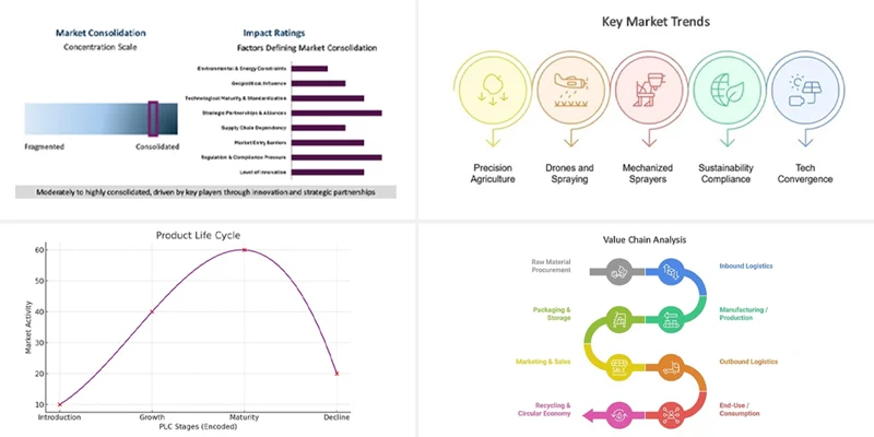
Product Life Cycle
Market Consolidation Analysis
Value Chain Analysis
Key Market Trends
State of Competition
Geospatial Solutions Market - Get online access to the report