Global Commercial Satellite Imaging Market By Application (Geospatial Data Acquisition & Mapping, Energy & Natural Resource Management, Defense & Intelligence, Disaster Management, Surveillance & Security, Urban Planning & Development and Others) By End User (Government & Defense, Forestry & Agriculture, Civil Engineering & Archaeology, Energy, Transportation & Logistics and Others)
Report Id: KBV-2806Publication Date: September-2019Number of Pages: 260Report Format: PDF + Excel
Special Offering:
Industry Insights | Market Trends Highest number of Tables | 24/7 Analyst Support
The Global Commercial Satellite Imaging Market size is expected to reach $4.7 billion by 2025, rising at a market growth of 11.3% CAGR during the forecast period. Increasing dependence on location-based services (LBS) is expected to drive the growth of the global market for commercial satellite imagery. This is linked to the fact that location-based services play a major role in the use of smart devices by providing real-time geographic data.
Satellite imaging works with the help of imagery satellites to capture images of the Earth or other planets. Using these images for commercial purposes is known as commercial satellite imaging that includes a variety of applications such as environmental monitoring & management, border area surveillance, energy resource security, and construction project mapping. Commercial satellite imaging is useful across different sectors, including transportation, defense, construction, and others that acts as a key driver of the satellite imagery market.
Satellite imaging applications are navigation, mapping, GIS, geomarketing and advertising, emergency and security applications, business applications, sport, augmented reality/games, mHealth, tracking and social networking. All these applications are designed to meet the various requirements and conditions of use. The surge in context-aware applications is predicted to further enhance market growth during the forecast period and the increasing number of devices shipments with location-based services.
Based on Application, the market is segmented into Geospatial Data Acquisition & Mapping, Energy & Natural Resource Management, Defense & Intelligence, Disaster Management, Surveillance & Security, Urban Planning & Development and Others. Based on End User, the market is segmented into Government & Defense, Forestry & Agriculture, Civil Engineering & Archaeology, Energy, Transportation & Logistics and Others. Based on Regions, the market is segmented into North America, Europe, Asia Pacific, and Latin America, Middle East & Africa. North America has represented the largest market share of commercial satellite imaging on the world market, due to the increase in adoption by government and military authorities of satellite imaging services. For purposes of map creation, military recognition, urban planning, disaster management, among others, Government and military organisations primarily use satellite images. In addition, the region government is making major investments in promoting the introduction of commercial satellites to promote regional overall growth.
The major strategies followed by the market participants are Product launches and Partnerships & Collaborations. Based on the Analysis presented in the Cardinal matrix, Thales Group S.A., Airbus SE, Leonardo SpA, and L3 Harris Technologies, Inc. are some of the forerunners in the Commercial Satellite Imaging Market. The market research report covers the analysis of key stake holders of the market. Key companies profiled in the report include Spaceflight Industries, Inc., Galileo Group, Inc., ImageSat International N.V., Maxar Technologies, Inc., Planet Labs, Inc., UrtheCast Corporation, Airbus SE, Saab Group (Vricon, Inc.), Trimble, Inc., Leonardo SpA, Thales Group S.A. and L3Harris Technologies, Inc.
The market players are adopting progressive strategies to leverage the opportunities of the market. Companies are focusing on innovative strategies to compete in the market space. For instance, In June 2019, BlackSky, a subsidiary of Spaceflight (US) collaborated with HawkEye 360 which helps the BlackSky to make the use of signal-detection data offered by HawkEye 360s formation-flying satellite constellation in its own web-based analytical services. In July 2019, Maxar signed an agreement with Esri in order to deliver its Vivid and Metro satellite imagery mosaics to Esri for use in geospatial applications.
In July 2019, Airbus SE signed a contract with French Agency for delivering four Earth Observation sats in order to achieve the resolutions. In September 2019, Thales Alenia Space has launched new Space Inspire satellite product line (INstant SPace In-orbit REconfiguration) for allowing transition from video broadcasting to broadband connectivity services while maximizing the effectiveness & efficient use of the satellite resources.
Recent Strategies Deployed in Commercial Satellite Imaging Market
» Product Launches:
Sep-2019: Thales Alenia Space has launched new Space Inspire satellite product line (INstant SPace In-orbit REconfiguration) for allowing transition from video broadcasting to broadband connectivity services while maximizing the effectiveness & efficient use of the satellite resources.
Aug-2019: Trimble has launched the Trimble® T7 tablet for GIS data collection applications.
Jul-2019: Vricon, a subsidiary of Saab launched CitySuite, its newest 3D data product in order to fulfill the demand of geospatial market.
Jul-2019: Thales Alenia Space introduced Euclid satellite which can generate hundreds of thousands of images and several tens of petabytes of data.
Jun-2019: Trimble introduced V10 Imaging Rover for capturing 360-degree digital panoramic images for efficient visual documentation and measurement of the surrounding environment.
Nov-2018: Spaceflight launched 12 spacecraft from India’s Polar Satellite Launch Vehicle (PSLV) for meeting the growing demand of smallsat industry.
May-2018: Leonardo introduced first satellite-controlled European MALE-class drone flight which helps in controlling unmanned platforms.
Mar-2018: BlackSky, a subsidiary of Spaceflight launched next generation of small Earth observation satellite, Global-1, which has the features of geolocation accuracy, image quality and on-orbit lifetime.
Feb-2018: Trimble released MX9 Mobile Mapping Solution integrated with vehicle-mounted mobile LIDAR system, multi-camera imaging and field software for data collection.
Dec-2016: Spaceflight introduced BlackSky global intelligence platform, as well as its Early Adopter Program (EAP) participants, and the diverse partner ecosystem fueling the platform which has the embedded features of satellite imagery, social media and other data feeds for revealing the relevant insights around specific locations and topics.
Jun-2016: Vricon, a subsidiary of Saab introduced Vricon Data Suite, the 0.5m resolution Digital Terrain Model (DTM), a high-resolution bare earth elevation data layer for automated processing.
» Acquisition and Mergers:
Jan-2019: UrtheCast acquired Geosys from Land O' Lakes, Inc. in order to enhance its business capabilities in space operations.
Oct-2017: MDA, a Maxar acquired DigitalGlobe in order to strengthen its space technology solutions.
Feb-2017: Planet Labs acquired Terra Bella, Google's Earth business for taking over the Earth imaging data from Planet.
Jul-2015: Planet Labs took over BlackBridge and its RapidEye constellation of satellites in order to strengthen its satellite imaging business.
» Partnerships, Collaborations and Agreements:
Jul-2019: Maxar signed an agreement with Esri in order to deliver its Vivid and Metro satellite imagery mosaics to Esri for use in geospatial applications.
Jul-2019: Airbus signed a contract with French Agency for delivering four Earth Observation sats in order to achieve the resolutions.
Jul-2019: Vricon, a subsidiary of Saab collaborated with Spatial Networks and Cesium for helping the governments and industry clients in getting complete information of remote environments.
Jul-2019: Thales signed an agreement with Indonesia’s Ministry of Communication and Information Technology in which Thales will design and manufacture the satellite named SATRIA for Indonesia.
Jun-2019: BlackSky, a subsidiary of Spaceflight collaborated with HawkEye 360 which helps the BlackSky to make the use of signal-detection data offered by HawkEye 360’s formation-flying satellite constellation in its own web-based analytical services.
Jun-2019: Maxar signed a contract with U.S. Government in order to help the government in fulfilling their mission requirements.
Jun-2019: Planet Labs signed an agreement with Kayrros in order to provide it the access to subscription-based Earth observation imagery and data.
Jun-2019: Airbus collaborated with Surrey Satellite Technology Limited for using end-to-end imaging operations and for enhancement of Vision-1, SSTL S1-4 Satellites.
Apr-2019: ImageSat teamed up with Kleos Space in order to explore the opportunities for using the Kleos’ maritime Radio Frequency (RF) activity-based satellite data which helps in increasing geospatial intelligence analytics.
Apr-2019: Leonardo signed an agreement with Petrobras for satellite monitoring which delivers 150 images per month from COSMO-SkyMed satellites constellation in order to detect the oil spills from production and exploration operations.
Feb-2019: Spaceflight signed Launch Services Agreement with Vector in order to launch the multiple satellites in space.
Dec-2018: MDA, a subsidiary of Maxar collaborated with Orbital Insight for delivering high-resolution imagery from its RADARSAT-2 synthetic aperture radar (SAR) satellite to Orbital Insight in order to help them in processing and transforming the data into actionable intelligence for the energy industry.
Dec-2018: Planet Labs teamed up with BASF in order to deliver timely satellite imagery and data to European farmers for helping them in making agronomics decision accordingly.
Sep-2018: Planet Labs signed partnership agreement with Orbital Insights for providing global imagery and advanced analytics to Orbital.
Sep-2018: Airbus came into partnership with Orbital Insight in order to build a comprehensive suite of geospatial analytics services and tools.
Sep-2018: Leonardo signed a MoU with Aireon LLC in order to combine the data from AireonSM into its ‘LeadInSky’ Air Traffic Management (ATM) solution for facilitating the deployment of space-based ADS–B data.
Jul-2018: UrtheCast signed a contract with European Commission for providing a large set of observation products and services to European Space Agency and European Commission; this contract has been led by the consortium of Airbus Defence and Space, Planet, IGN-France and space4environment.
Jun-2018: ImageSat integrated with Magnus for the launch of Disaster Management services which utilizes the ImageSat International’s ISI satellite intelligence services in order to control and mitigate the natural disasters and crisis situations; also, obtain satellite imagery and analytics on demand for maintaining the updated situational awareness on large scale.
Jun-2018: Planet Labs came into partnership with Airbus in order to enable access to each other's data and joint cooperation on new geospatial solutions development.
Mar-2018: Spaceflight came into partnership with Thales Alenia Space and Telespazio in order to develop smallsats and offer geospatial services.
Dec-2017: UrtheCast signed an agreement with Space View Technology in order to distribute their respective space technology portfolio.
Oct-2017: UrtheCast collaborated with e-GEOS in order to integrate high-resolution radar data with medium and very-high resolution optical imagery for providing exceptional decision making insights to the customers..
Jul-2017: UrtheCast came into partnership with Esri in order to enable the users of Esri to access reliable and quality assured imagery directly into their laptops and apps.
Mar-2017: Airbus teamed up with FD for developing the innovative approach for large scale processing of geospatial data with the use of its Kx analytics platform.
Mar-2017: Vricon, a subsidiary of Saab signed an agreement with Esri in which the products of the company will be sold by Esri for streamlining the acquisition process.
Nov-2016: Vricon, a subsidiary of Saab came into partnership with European Space for providing the high resolution 3D geodata products to the European government.
Jul-2016: UrtheCast partnered with OmniEarth in support of UrtheCast's planned UrtheDaily Constellation which is capable of imaging 140 million square kilometers of the global landmass every day at 5 meters GSD.
Jan-2016: Airbus partnered with HIS for delivering satellite imagery analytics.
Scope of the Commercial Satellite Imaging Market Analysis
Market Segmentation:
By Application
Geospatial Data Acquisition & Mapping
Energy & Natural Resource Management
Defense & Intelligence
Disaster Management
Surveillance & Security
Urban Planning & Development
Others
By End User
Government and Defense
Forestry & Agriculture
Civil Engineering & Archaeology
Energy
Transportation & Logistics
Others
By Geography
North America
US
Canada
Mexico
Rest of North America
Europe
Germany
UK
France
Russia
Spain
Italy
Rest of Europe
Asia Pacific
China
Japan
India
South Korea
Singapore
Malaysia
Rest of Asia Pacific
LAMEA
Brazil
Argentina
UAE
Saudi Arabia
South Africa
Nigeria
Rest of LAMEA
Companies Profiled
Spaceflight Industries, Inc.
Galileo Group, Inc.
ImageSat International N.V.
Maxar Technologies, Inc.
Planet Labs, Inc.
UrtheCast Corporation
Airbus SE
Saab Group (Vricon, Inc.)
Trimble, Inc.
Leonardo SpA
Thales Group S.A.
L3Harris Technologies, Inc.
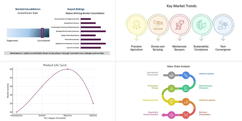
Product Life Cycle
Market Consolidation Analysis
Value Chain Analysis
Key Market Trends
State of Competition
Commercial Satellite Imaging Market - Get online access to the report