The Asia Pacific Aerial Imaging Market would witness market growth of 16.2% CAGR during the forecast period (2024-2031).
The China market dominated the Asia Pacific Aerial Imaging Market by Country in 2023, and would continue to be a dominant market till 2031; thereby, achieving a market value of $928.1 million by 2031. The Japan market is registering a CAGR of 15.4% during (2024 - 2031). Additionally, The India market would showcase a CAGR of 16.8% during (2024 - 2031).

These imaging is vital in comprehensive ecosystem monitoring, including tracking soil erosion, detecting forest diseases, and observing land-use changes. In arid regions, aerial surveys have effectively monitored rangeland health and prevented soil degradation. These technological advancements support long-term environmental strategies by supplying accurate data for climate change studies and conservation planning.
Economic factors are pivotal in expanding the market by driving rapid innovation and enhancing technological capabilities. Substantial investments in research and development from both private companies and government initiatives have accelerated the evolution of imaging sensors and data analytics.
This market in Asia Pacific is experiencing rapid growth. China has emerged as a global leader in this imaging, driven by government-backed initiatives that promote technological advancements across industries. The Chinese government has heavily invested in geospatial intelligence and drone technology under programs like Made in China 2025, which aims to strengthen the nation’s AI-driven aerial imaging, remote sensing, and high-resolution satellite imaging capabilities. The Ministry of Natural Resources has also implemented policies integrating aerial mapping in urban planning, agriculture, and disaster response, enabling real-time land use and infrastructure monitoring. Furthermore, the National Civil Space Infrastructure Plan supports the expansion of satellite-based aerial imaging, ensuring high-resolution data collection for industrial applications. With significant government funding and regulatory support, this imaging in China continues to expand across commercial, defense, and environmental sectors, making it a key driver in the country’s digital transformation. Hence, the region will present lucrative growth opportunities to expand the market.
Free Valuable Insights: The Global Aerial Imaging Market is Predict to reach USD 8.73 Billion by 2031, at a CAGR of 15.7%
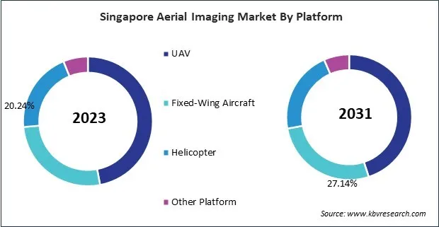
Based on Platform, the market is segmented into UAV, Fixed-Wing Aircraft, Helicopter, and Other Platform. Based on Application, the market is segmented into Geospatial Mapping, Surveillance & Monitoring, Energy & Resource Management, Disaster Management, and Urban Planning & Other. Based on End Use, the market is segmented into Government, Agriculture & Forestry, Military & Defense, Energy, Civil Engineering, Commercial, Media & Entertainment, and Other End Use. Based on countries, the market is segmented into China, Japan, India, South Korea, Singapore, Malaysia, and Rest of Asia Pacific.

By Platform
By Application
By End Use
By Country
Our team of dedicated experts can provide you with attractive expansion opportunities for your business.

